

The Indian Geospatial Market in the next decade or so is going to be driven by strategic policy imperatives released by the Government of India, geospatial incubation and accelerator programs, and geospatial focus on national mission-mode projects. It is estimated that the geospatial market is going to take the Indian geospatial economy to approximately INR 100,000 crores by 2030, which is going to add almost 2% growth to the overall GDP. Furthermore, the impact of geospatial data and technologies in the Indian economy is going to be manyfold-enhancing efficiency, productivity, and effectiveness across varied sectors, and for socio-economic development.
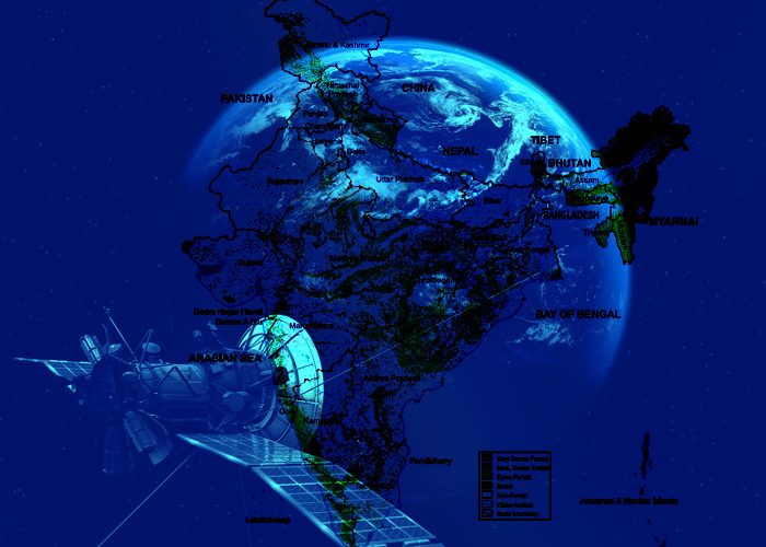
Geospatial Data and Information
Geospatial data is information that represents objects, events, or other features with a location on or near the surface of the earth. Geospatial data typically combines location information (usually coordinates on the earth) and attribute information (the characteristics of the object, event, or phenomena concerned) with temporal information (the time or life span at which the location and attributes exist). The location provided may be static in the short term (for example, the location of a piece of equipment, an earthquake event, or children living in poverty) or dynamic (for example, a moving vehicle or pedestrian, the spread of an infectious disease).
Geospatial information is widely used by various departments for example – weather forecasts or is used as a navigation tool by people to track the location of a person, place, or object. However, it is not limited to just that. Tracking live delivery of food products on Swiggy or Zomato, or the live location on WhatsApp or Ola are also made possible due to the geospatial data and geospatial data services.
The list of industries where geospatial technology is required extends from ecology, tourism, marine sciences, healthcare, agriculture, and forestry to defense, law enforcement, logistics, and transportation.
India’s Geospatial Economy
The Indian Economy is set to re-emerge as one of the fastest-growing economies of the world. The country’s economic recovery is driven by the Indian government’s visible strategic reforms and impetus to all economic sectors, accelerated and sustained efforts to provide vaccination coverage against COVID-19 to all citizens, and significant improvement in overall monetary and credit conditions.
The Indian geospatial market is on the verge of a significant transformation owing to the profound changes in the geospatial policy environment in the country
Indian geospatial economy is expected to reach Rs. 63,000 crores (US$ 7.67 billion) by 2025 at a growth rate of 12.8%, and is also expected to employ more than 10 lakh people mainly through geospatial start-ups, said Dr. Jitendra Singh, Minister of State (Independent Charge) Science & Technology; Minister of State (Independent Charge) Earth Sciences; MoS PMO, Personnel, Public Grievances, Pensions, Atomic Energy and Space. He was addressing the Second United Nations World Geospatial Information Congress (UN-WGIC) 2022 in Hyderabad on October 11, 2022.
Over 2,000 delegates, including 700 or more international delegates and participants from about 150 countries, are attending the 5-day conference. More than 250 geospatial start-ups in India are showcasing the uses of geospatial technology in a variety of fields, including waste resource management, forestry, urban planning, and road mapping, said Dr. Singh. An international GIS services market will be developed for the Indian geospatial industry with the help of geospatial science, technology, and skilled labor.
What is your reaction?


You may also like

Leadership Style of Ratan Tata: Lessons for Indian Entrepreneurs

Cabinet Approves India-Japan Chip Supply Chain Partnership